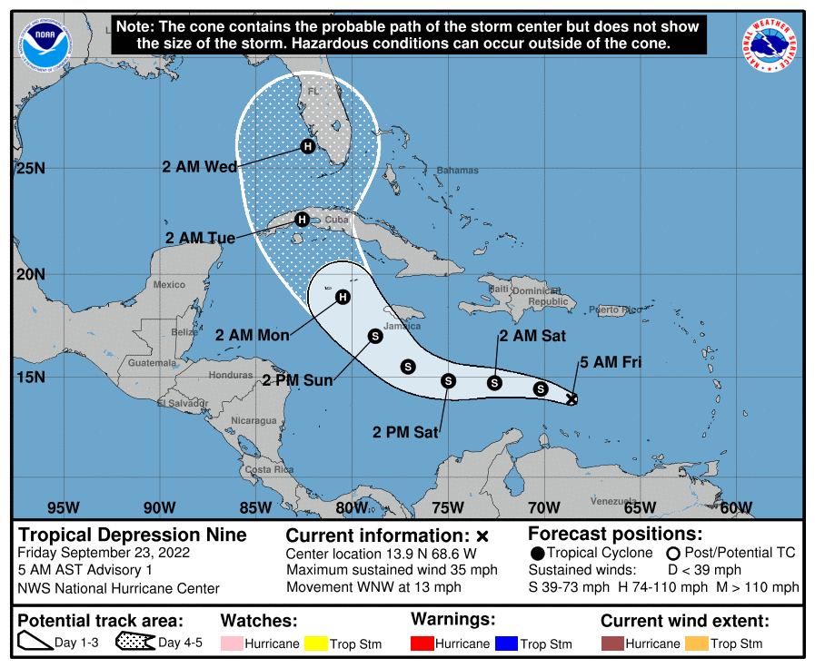
Tropical Depression Number 9 has formed in the Caribbean Sea, according to the National Hurricane Center. The storm is expected to increase in strength into a tropical storm later today, and then a hurricane. When it does so, it will assume the name Ian.
The storm, which has lingered near the northern shores of South America as it organized itself, may eventually target the Gulf Coast of Florida as a major hurricane by the middle of next week, with winds that could reach over 120 MPH, according to the latest tracking models. This far in advance, the models should be taken as a general precaution, as the storm could veer widely off of this path, according to weather scientist from the National Oceanic and Atmospheric Administration.
Businesses along the western coast of Florida should prepare as the storm approaches.
“The depression is expected to approach Jamaica and the Cayman islands as an intensifying tropical storm… then is forecast to approach western Cuba and enter the southeastern Gulf of Mexico… Interests in Cuba and along the Eastern Gulf Coast of the United States should closely monitor this system.” ~ NHC Advisory.
NHC tracking plot for Tropical Depression 9 / Ian: https://www.nhc.noaa.gov/refresh/graphics_at4+shtml/090354.shtml?cone#contents
Thanks for reading CPA Practice Advisor!
Subscribe Already registered? Log In
Need more information? Read the FAQs
Tags: Small Business, Taxes


